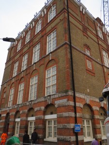
SIGHT (Hanbury Street): Continue north along Commercial Street and make a turn on to the first street on the right, Hanbury Street. On the north side of street, you’ll see parts of the Old Truman Brewery. Its history goes back to the 17th century, and for a few decades in the 19th century it was the largest brewing facility in the world. On the morning of September 8, 1888, Jack the Ripper killed his second victim, Annie Chapman, in the backyard of 29 Hanbury Street. Nothing remains of the backyard or the original houses, the area having been taking over by the brewery in the first part of the 20th century. The brewery closed down 1989, and today the old brewery grounds have been redeveloped as a major arts and media quarter, and the home of several small media businesses, cafés and shops.
SIGHT (Brick Lane): The next thoroughfare is Brick Lane. Originally known as Whitechapel Lane, Brick Lane was a center of jewish immigration in the 19th century and Bengali immigration in the 20th century. The street is now known as the curry capital of the UK, but also features the legendary Brick Lane Beigel Bake, one of the few remants of its jewish heritage. It is also the namesake of Monica Ali’s bestselling 2003 novel about a young Bangladeshi woman who moves from her native country to London at the age of 18, settling in Whitechapel to marry an older man.
PINTS (The Pride of Spitalfields): There are lots of small shops, food outlets etc. on Brick Lane, but amazingly no pubs remain on the street, the nearest one being The Pride of Spitalfields just down Heneage Street, a few streets down of the left from where you arrived at Brick Lane. Originally known as the Romford Arms, the pub was renamed in the 1980s and was awarded “East London Pub of the Year” by CAMRA in 2013. Have some food on Brick Lane, and go have a pint at The Pride.
SIGHT (Altab Ali Park / The white chapel): Continue down Brick Lane and its short extension Osborne Street, and you’ll find yourself at Whitechapel Road across from the Altab Ali Park. The park was once the site of the white Chapel of St. Mary Matfelon, which gave its name to entire area of Whitechapel. The chapel itself was destroyed during the blitz in 1940, and today only the floor plan and a few graves remain. The park was renamed Altab Ali Park in 1998 in memory of a young Bangladeshi clothing worker, who was murdered on the adjacent Adler Street in 1978. The park also features a monument in commemoration of the Bengali Language Movement.
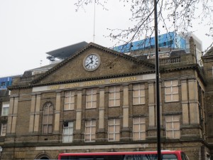
SIGHT (Whitechapel Road / London Hospital): The Whitechapel Road is the major thoroughfare of the East End, and it follows the route of the first leg of the ancient Roman road connecting Londinium (London) and Camulodnum (Colchester). It is today a major shopping street and a center of Muslim culture. Walk east on the road for a bit to experience a number of south east asian shops, the East London mosque and the iconic Royal London Hospital, founded in 1740. The facade of the original 1757 facade of the hospital still exists, but the hospital grounds are otherwise dominated by a massive multi-storey development, which opened in 2012. The free of charge Royal London Hospital Museum is housed in the crypt of a 19th century church in the back of the hospital, and features exhibitions on Jack the Ripper, the Elephant Man and on the nurse Edith Cavell, who was executed by a German firing square during World War I.
PUB (The Blind Beggar): When you are done exploring the hospital grounds and the museum (if you like), continue a bit further east on the Whitechapel Road, until you see The Blind Beggar on the north (left) side. The Blind Beggar, founded in 1894, has a huge outside beer garden, but is mostly famous for its association with the Kray twins, arguably the most famous mobsters in London history. On March 9, 1966, Ronnie Kray shot and killed rival mobster George Cornell, for which he was later sentenced to life imprisonment. Just over a century before that, Salvation Army founder William Booth held his first open air sermon outside the pub. Booth is commemorated by a nearby statue.
OPTIONAL SIGHT (Durward Street / Bucks Row): If you are into Jack the Ripper walk back in the direction from whence you came on Whitechapel Road, turning right on Brady Street and left on Durward Street. Durward Street was once known as Bucks Row, and on August 30, 1888, the mutilated body of Polly Nichols was discovered between the board school, which still stands on the right side of the street, and a row of terraced cottages on the other side, long since gone. Apart from the building which housed the board school, Durward Street has been almost entirely redeveloped in recent years.
SIGHT (Commercial Road): Now make your way to Commercial Road, taking either Cavell St. on the east side of the London Hospital or New Street on the west side, depending on whether you chose to visit Durward Street. The first actual meeting of what later became the Salvation Army was held in 1865 on 23 New Street. Commercial Road is today a busy thoroughfare and shopping street, connection the City of London with the new financial district at Canary Wharf. Make you way back towards the city until you reach the Skyline Plaza building on the corner of Henriques Street.
SIGHT (Henriques Street): Henriques Street, named for Jewish philantropist Sir Basil Henriques, was formerly known as Berner Street, and a little after midnight on September 30, 1888, Jack the Ripper made his third killing at the entrace of Dutfield’s Yard. The victim was a swedish prostitute by the name of Liz Stride. The killer might have been disturbed, as Stride did not show the same signs of having been mutilated as the other victims of the Ripper, but just an hour later he finished his job by killing and mutilating Catherine Eddowes at Mitre Square, which you passed earlier. Dutfield’s Yard stood on the right hand side of the street near the corner of Fairclough Street.
Continue down Henriques and make a right turn on Boyd St. until reach the Back Church Lane.
PUB (Dog and Truck): On the corner of Boyd St. and Back Church Lane you’ll find the Dog and Truck Pub. This is somewhat off the beaten track, and the least touristy pub you’ll see today. It is fairly large, offers good service and a nice, local crowd. You can also have a game of darts or billiards if you like.
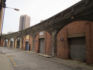
SIGHT (Pinchin Street / Rail viaduct): Continue south along Back Church lane until just before the railway viaduct. On your left hand is Pinchin Street, and a preserved part of an older viaduct, now disused. On September 10, 1889 a headless female torso was discovered in one of the first arches (now bricked up). It was speculated that Jack the Ripper, whose last murder was otherwise thought to have taken place on September 30 in the previous year, might have been the culprit. However, most modern experts have dismissed that theory. Neither the victim nor the murderer were ever identified. Railway and bridge buffs may find the remaining part of the viaduct quite fascinating.


